Here is the current Google maps satellite view of the Ara Pacis Museum. It looks like this shot is at least a year old - it appears that the current, new museum is under construction:
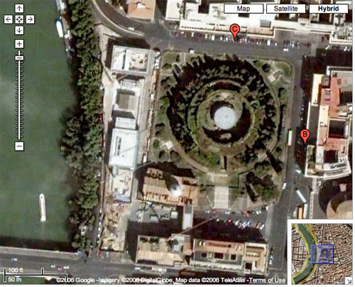
You can also plainly see the Mausoleum of Augustus and the two churches (San Girolamo degli Schiavoni and San Rocco) that are directly south of the mausoleum. Part of the criticism of the new museum is that the wall that runs along the Lungotevere (hidden by the trees - it is the road along the Tiber) cuts off the view of these churches from passing motorists and people on the sidewalk.